The north / Le Septentrion
Rhumsiki and the Mandara peaks
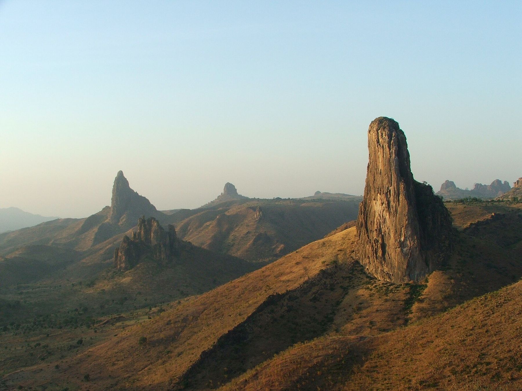
In the Mandara Mountains near the Nigerian border, old volcanic plugs rise like stone towers over Kapsiki villages, in one of the most striking landscapes in Central Africa.
Read this first À lire d'abord
The Far North region of Cameroon has had serious security problems for more than a decade. Armed groups operating across the border from Nigeria have attacked villages, kidnapped residents and foreigners, and forced many people from their homes, and the Mandara Mountains lie close to that border. Tourism in Rhumsiki, once one of the busiest destinations in the country, has largely stopped as a result.
Before you think about a visit, read your government's current travel advice for the Far North. Many governments have advised against all travel to this region for years, and that advice can affect your insurance. Nothing in this guide means the area is safe now. It describes a place that has mattered a great deal to Cameroonians and visitors, so that you understand it, and so that you can judge for yourself, with current information, if and when travel becomes possible.
A landscape of stone towers Un paysage de tours de pierre
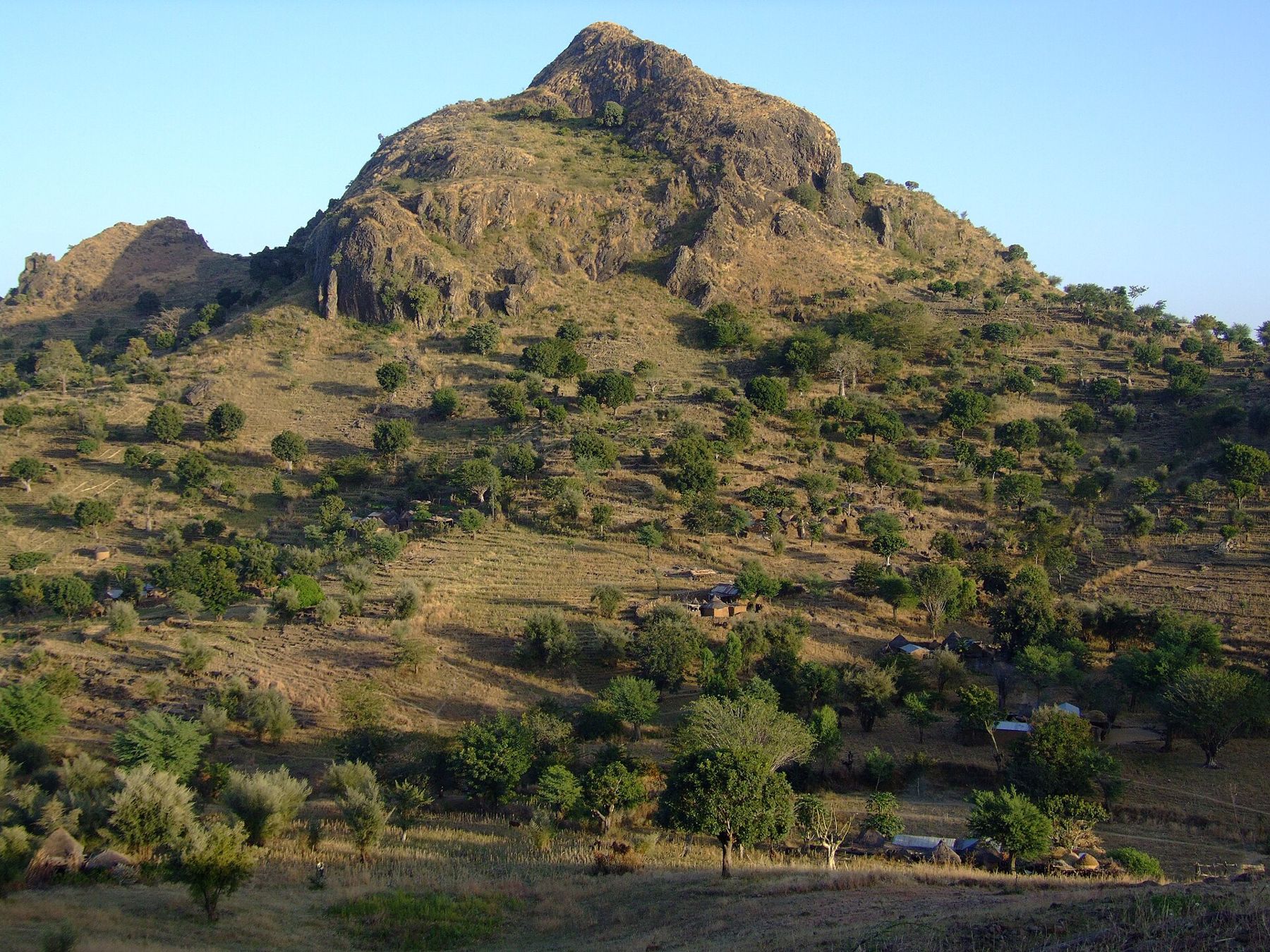
Rhumsiki is a village in the Mandara Mountains, a range of granite hills and plateaus that runs along the border between Cameroon and Nigeria. What makes the area around it extraordinary are the volcanic plugs: towers of hard rock, the solidified cores of old volcanoes, left standing after the softer cones around them wore away. They rise sheer from the hills, some as single spires, others as jagged crowns of rock.
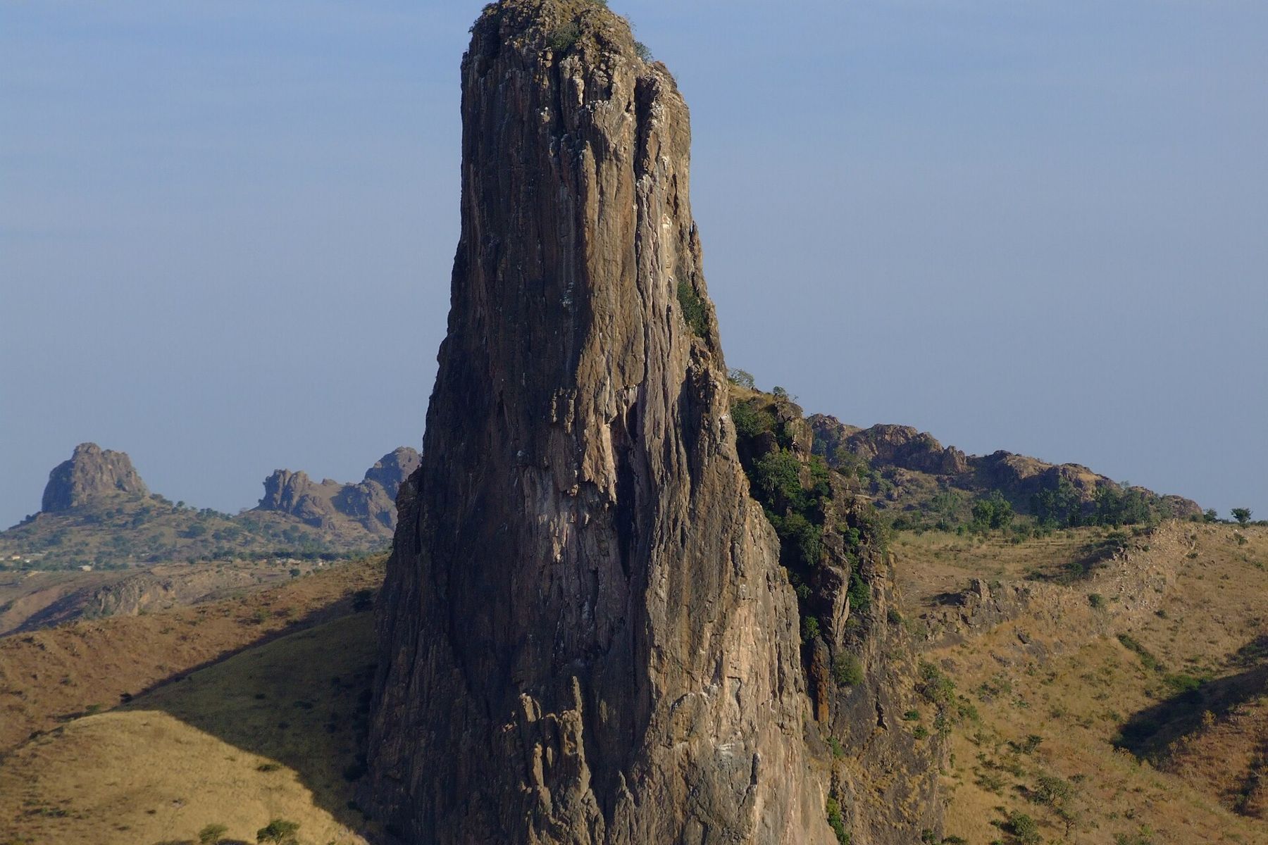
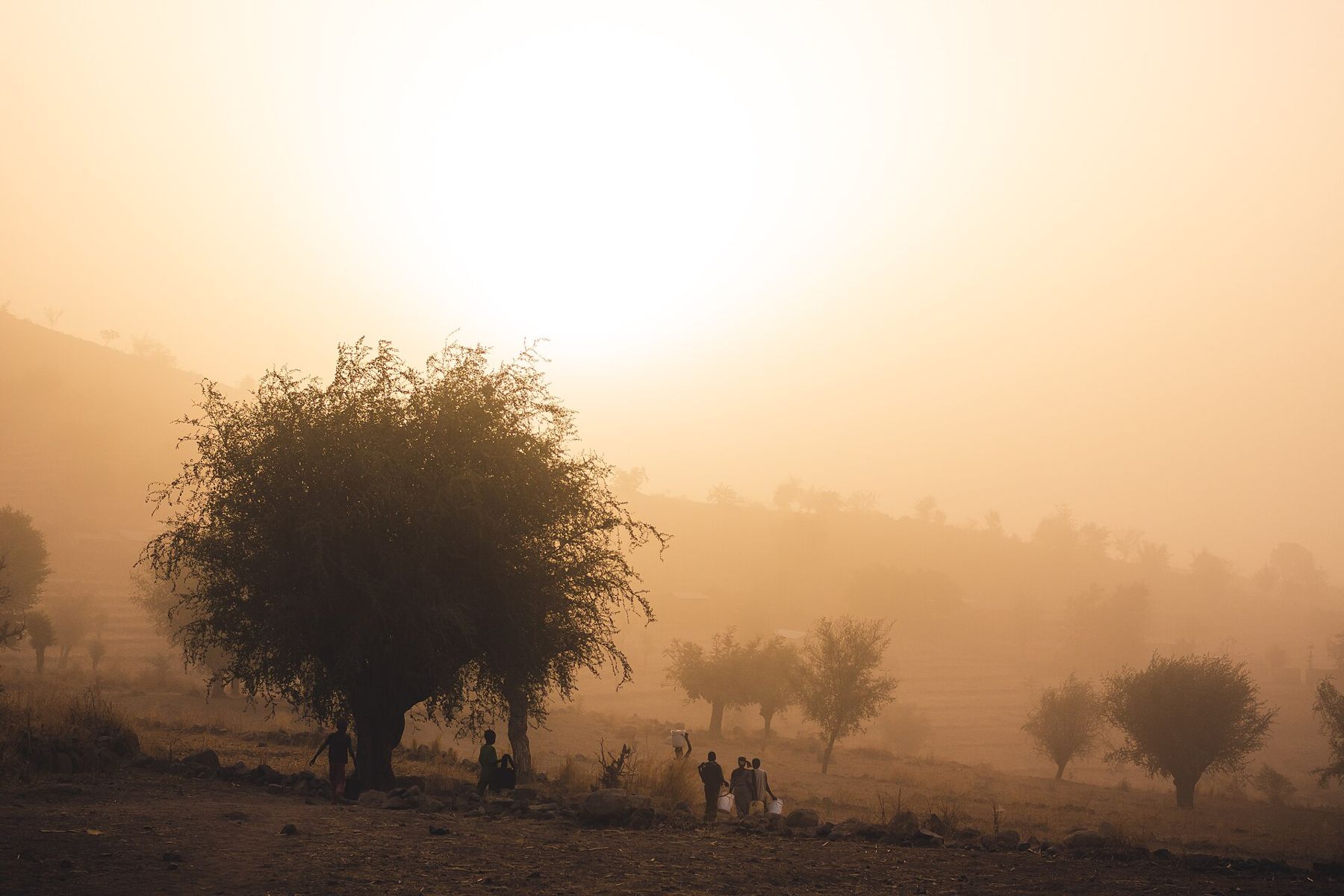
The best known stands just outside the village, a tall column of grey and brown rock that turns gold in the late afternoon. From the escarpment near the village you can see a whole line of peaks stretching towards the border, with valleys of millet fields and scattered trees between them. In the dry season the air is often thick with harmattan dust blown from the Sahara, softening the light into shades of orange and grey.
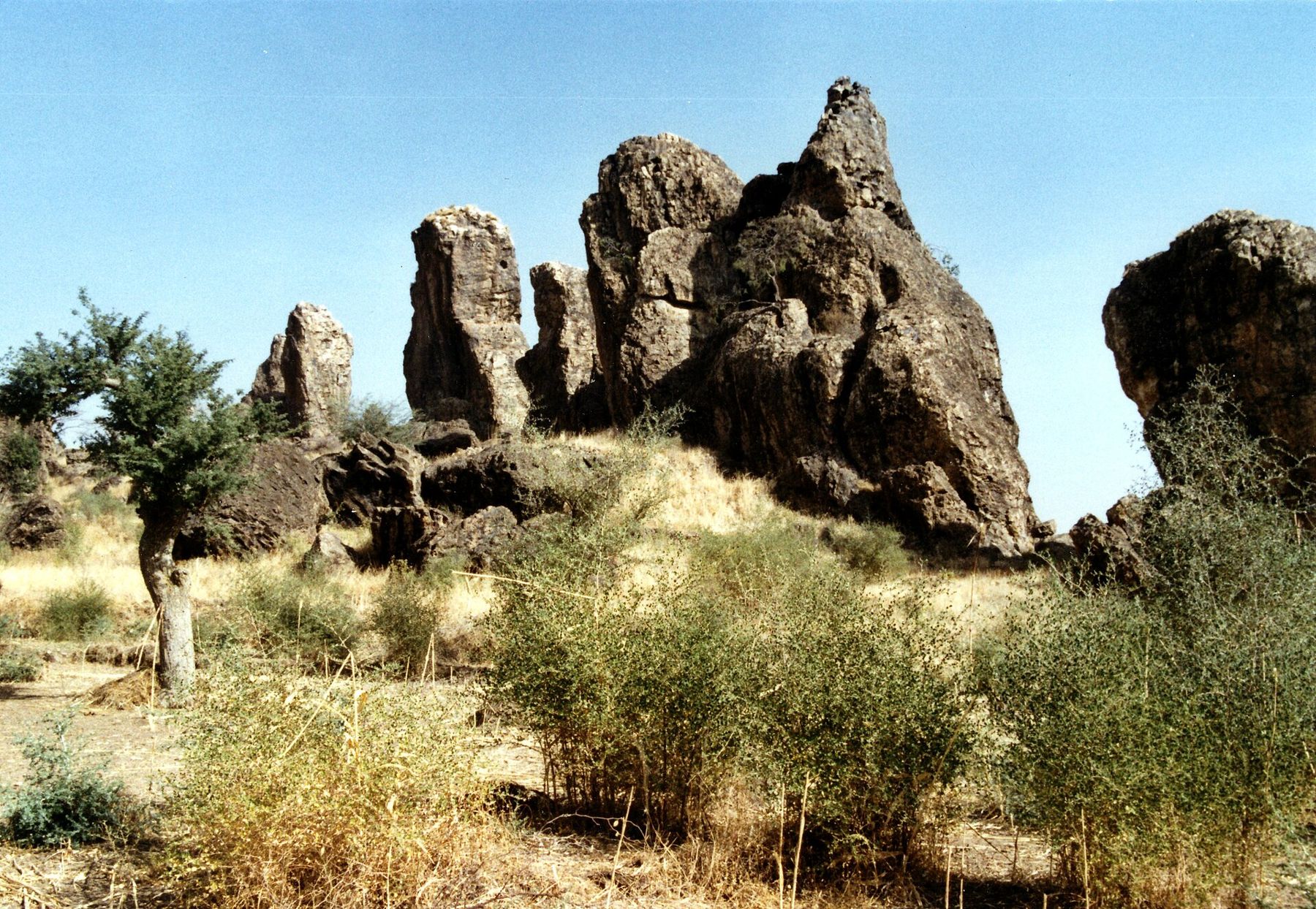
Walking is the way to see the landscape. Paths lead between villages, along terraced slopes and around the bases of the peaks. The rocks themselves are steep and loose in places, and climbing them is not a casual undertaking.
The geology explains the shapes. Millions of years ago, magma rose through the granite of the region and cooled in the throats of volcanoes. The ash and softer rock of the cones eroded over time, while the hard cores remained, which is why the peaks stand alone with such steep sides. Seen from the plateau at dawn or dusk, with the valleys still in shadow, the plugs look almost like the ruins of towers, and many local stories attach names and meanings to individual rocks.
Kapsiki villages Les villages kapsiki
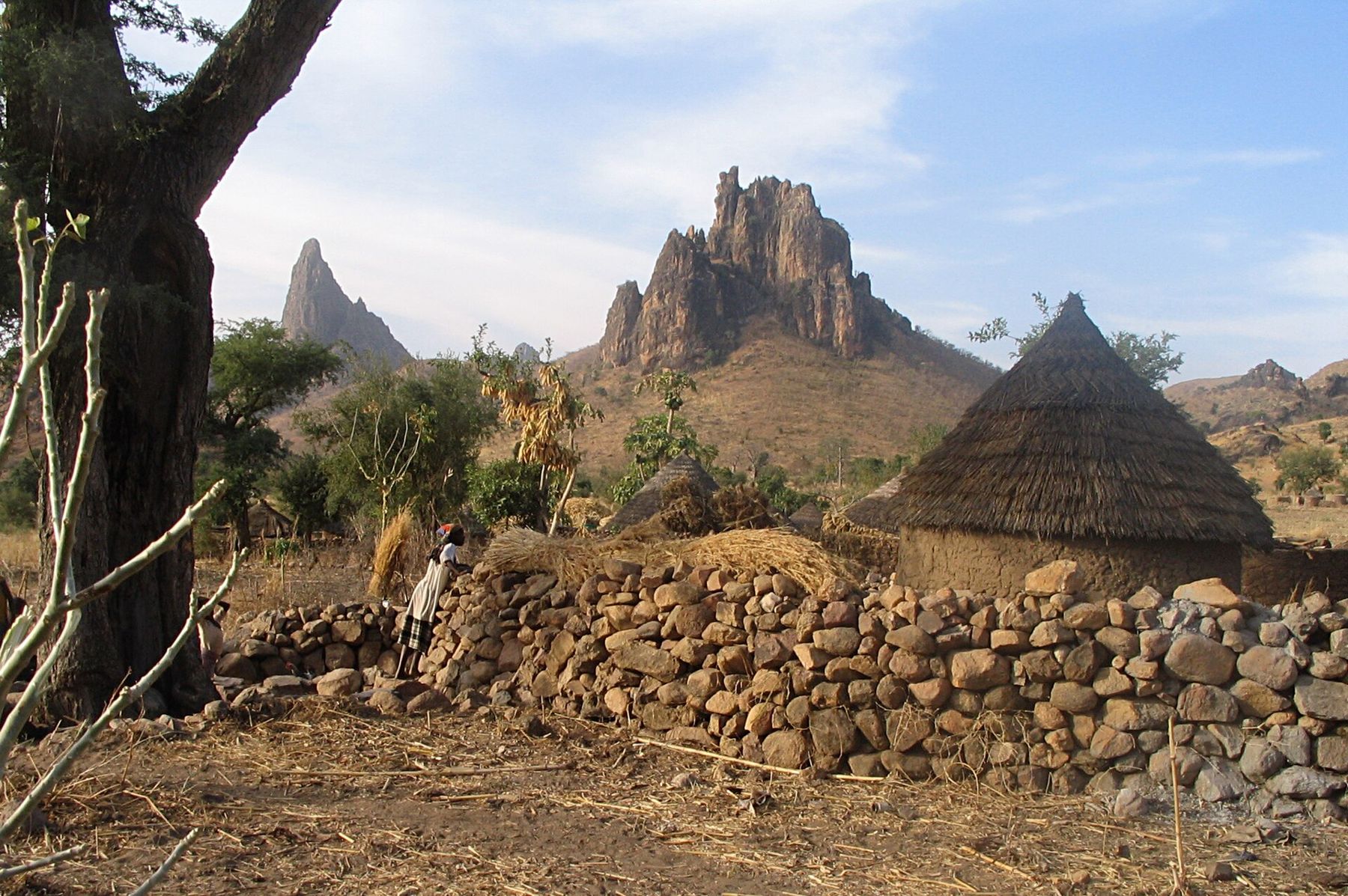
The Kapsiki people live in this part of the Mandara Mountains; across the border in Nigeria, closely related communities are known as the Higi. Their villages are made up of family compounds: round houses of stone and earth with conical thatched roofs, linked by walls and granaries, set among fields of millet, sorghum and groundnuts. Dry-stone terraces hold the thin soil on the slopes, the result of generations of careful work.
Kapsiki society has its own traditions of craft and ritual. Blacksmiths form a distinct group with special roles in ceremonies, and potters and weavers sell their work in the markets. Divination is part of village life, and the crab diviner, who reads the movements of a freshwater crab in a pot of wet sand, became famous among visitors when tourism was strong. Treat any such practice as part of people's lives, not as a show.
Treat any such practice as part of people's lives, not as a show.Detour / détourWaza National Park
Markets are the meeting places of the mountains. On market days people walk in from surrounding villages to trade grain, livestock, pottery, iron tools, cloth and millet beer, and the gathering is as much social as commercial. Mokolo and the larger villages hold weekly markets, and they show the region's mix of Kapsiki, Mafa, Fulbe and other communities, with several languages heard at every stall.
Village etiquette is simple and important. Greet people before anything else, ask before taking photographs, and accept a refusal without argument. Do not enter a compound without being invited. When tourism was active, a local guide from the village was the normal way to walk between compounds, and paying for a guide put money directly into the community.
Seasons and the land Les saisons et la terre
The Far North has one rainy season, usually from around June to September, when the hills turn green, rivers run and the tracks become difficult. The dry season follows, cool and clear at first, then increasingly dusty with the harmattan, and very hot from March to May.
Farming follows the rains. Millet and sorghum are sown as the first storms arrive and harvested as the land dries, and the granaries beside each house are filled for the long months ahead. Water is the constant concern of the dry season, when wells and seasonal streams shrink and people walk long distances to fetch it.
The months from November to February were the classic time to visit, with dry paths and bearable heat. Early mornings are the best part of the day for walking and for light on the peaks; by noon the sun is fierce, and shade is scarce.
The wider north Le Grand Nord
The wider Mandara range holds many other villages and peaks, and the communities across it share terraced farming, stone compounds and a long history of living in the hills.
Rhumsiki is reached from Maroua, the regional capital, by way of the market town of Mokolo. Maroua has an airport with domestic flights, though schedules have been irregular, and the city has long been a base for travel in the region. Further north lies the savanna of Waza National Park, affected by the same security problems.
The journey north from the south of the country is long. Many travellers took the train from Yaoundé to Ngaoundéré on the Adamawa plateau and continued by road through Garoua. That gives a sense of how big Cameroon is, and how different the north feels from the forest and coast: drier, hotter, with Fulfulde and many local languages alongside French.
For entry rules, health requirements and travel across Cameroon, see the guide to planning a trip. If the security situation improves, the Mandara Mountains will again offer one of the great walking landscapes in Africa. Until your government's advice says otherwise, consider other parts of the country, and watch for change.