Mount Cameroon and the west / Le mont Cameroun
Climbing Mount Cameroon
West Africa's highest mountain is an active volcano that rises from the sea to over 4,000 metres. Climbing it takes two or three hard days, a guide and good timing.
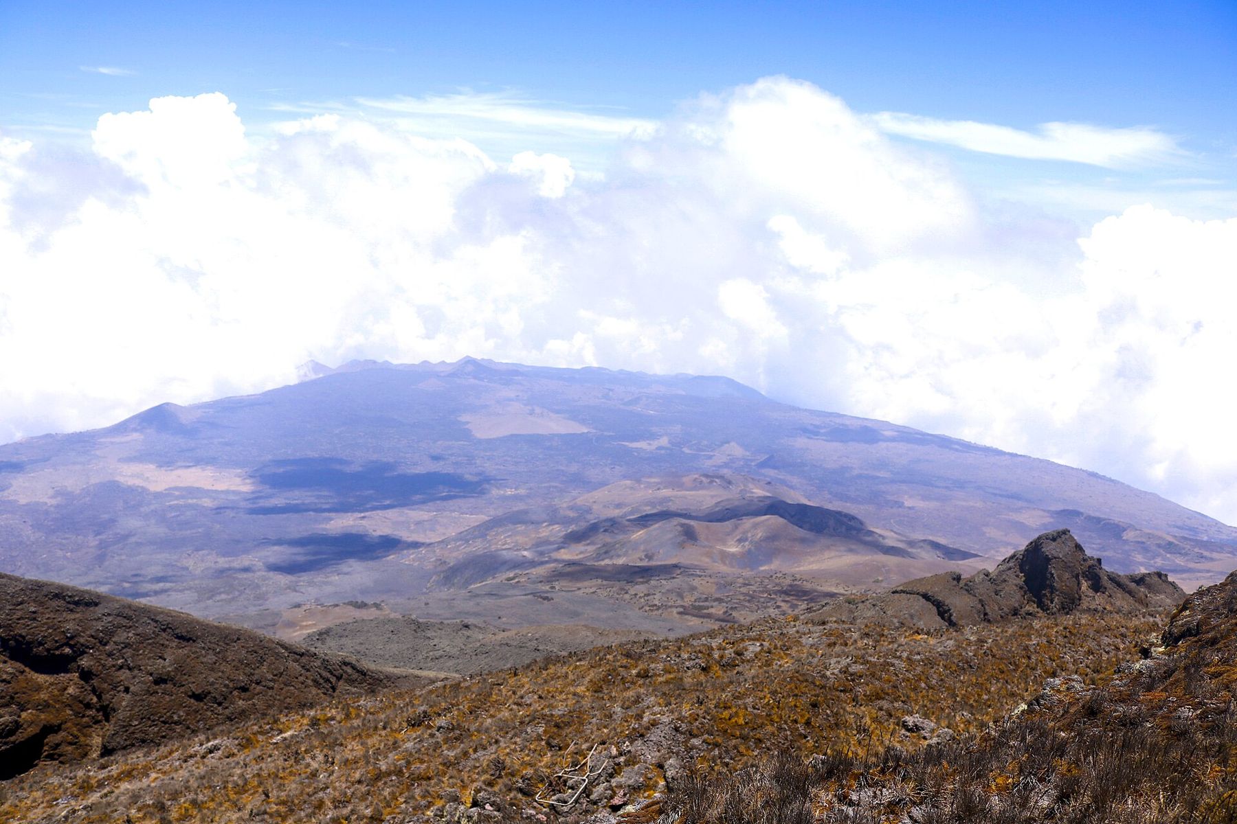
Mount Cameroon rises straight out of the Atlantic coast to just over 4,000 metres, the highest point in West and Central Africa. Its lower slopes are farmland and plantations, its middle reaches are rainforest and its upper slopes are open grassland and bare volcanic rock. It is an active volcano, it makes its own weather, and it is climbed on foot from the town of Buea in two or three demanding days.
Starting early gives you the best chance of a view before the cloud builds.
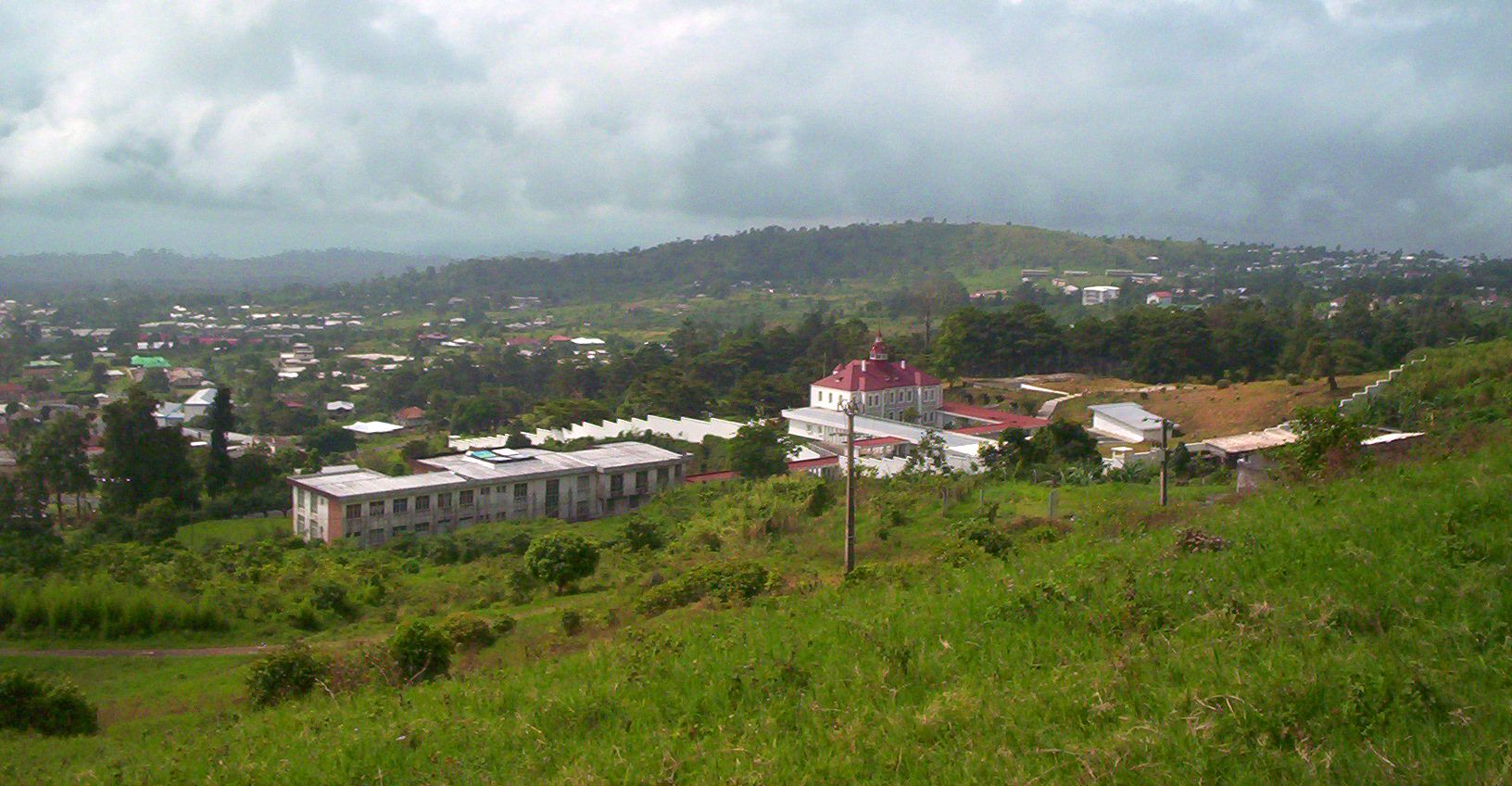
The mountain called Fako La montagne appelée Fako
Local people call the summit Fako, and the mountain is part of the homeland of the Bakweri people, who farm its lower slopes and hold it in deep respect. The mountain and its forests are protected as Mount Cameroon National Park, which covers much of the massif.
The ascent is not technical: there is no rope work or climbing gear needed. It is, however, long, steep and relentless, with a big gain in height in a short distance. Good fitness matters more than experience, and you should be comfortable walking for many hours on rough ground.
At just over 4,000 metres, the summit is high enough for some climbers to feel headaches, breathlessness or nausea, and the fast ascent gives the body little time to adjust. Drink plenty, keep a steady pace and tell your guide if you feel unwell; going back down is the best remedy. Spending a night in Buea before the climb helps you settle the arrangements, check your gear and get used to the cooler air.
How the climb works Comment se déroule l'ascension
Climbs are organised in Buea, where registered guides and porters can be hired and park fees paid. Going with a guide is required and is also simply sensible: paths divide, cloud closes in fast and the upper slopes are featureless. Porters carry food, water and camping kit, and hiring them supports families in the villages around the mountain.
The usual plan is two or three days. The main route climbs from the edge of Buea through farms and forest to a series of simple huts, numbered from the bottom, where climbers sleep or rest. A strong walker can reach the summit early on the second day and descend the same day; a three-day trip allows a gentler pace and a night higher up. Some routes descend by a different path towards the western side, making a longer traverse. Fees, rules and hut conditions change, so check the current arrangements in Buea before you set off.
Agree clearly in advance what the price includes: guide, porters, food, water, park fees and the use of huts or tents. Tips for guides and porters are customary at the end of a climb. Carry all rubbish back down with you; the mountain has no collection service, and litter at the huts spoils the place for everyone.
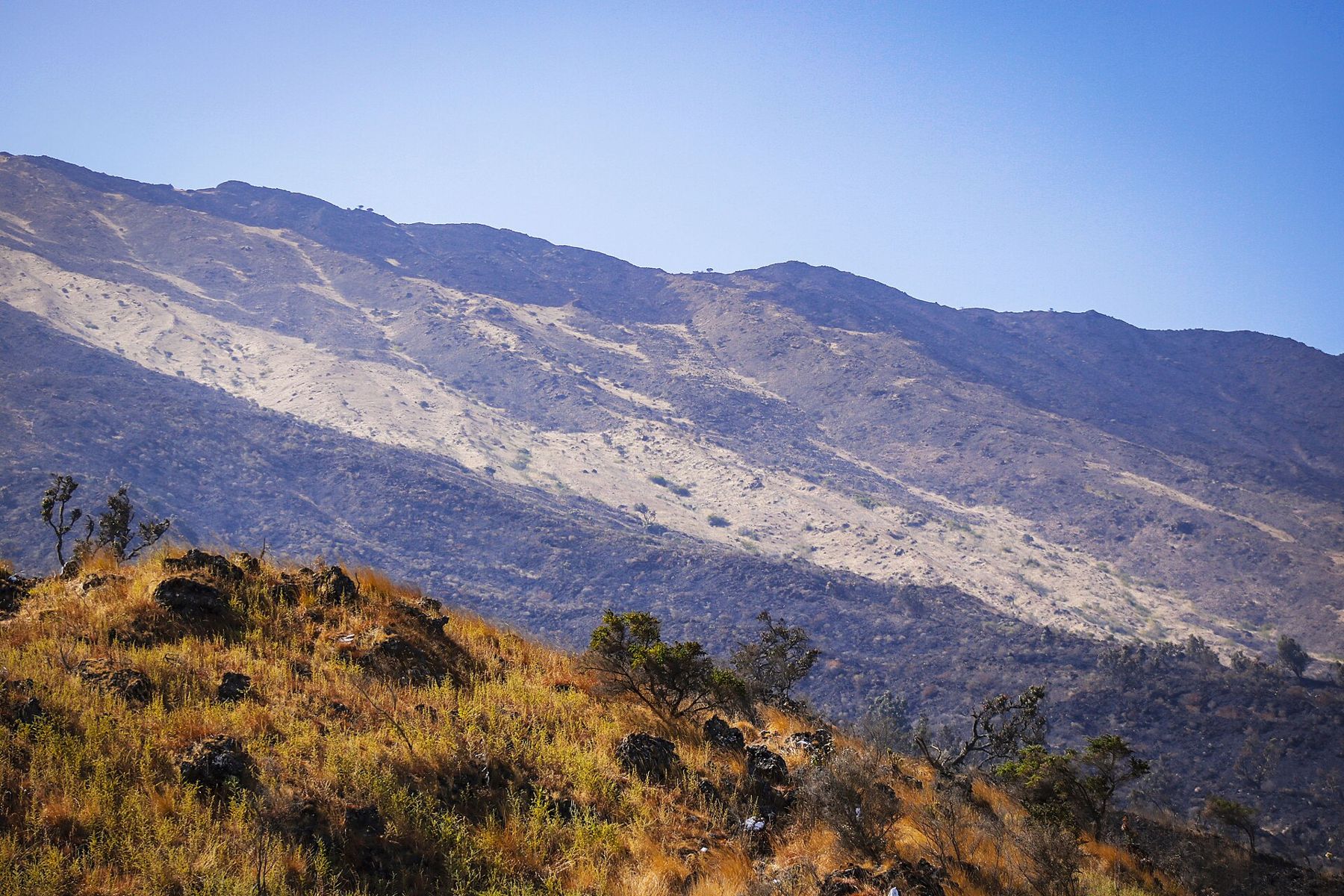
Water is scarce above the forest, so carry enough for each stage and ask your guide where the springs are. Temperatures near the summit can drop close to freezing at night, while the forest below is warm and humid. Bring layers, a waterproof jacket, gloves, a hat and a head torch, and wear boots with good grip for the loose scree on the way down.
Detour / détourBuea, the cool town on the slopeFrom forest to scree De la forêt aux éboulis
The climb passes through clear bands of vegetation. Above the farms, dense montane forest closes over the path, full of birdsong and dripping with moisture. Higher up, the trees stop abruptly and you emerge onto open grassland, often in sunshine above a sea of cloud. In the last stretch, the grass thins out into black and red volcanic rock, cinder cones and old lava flows.
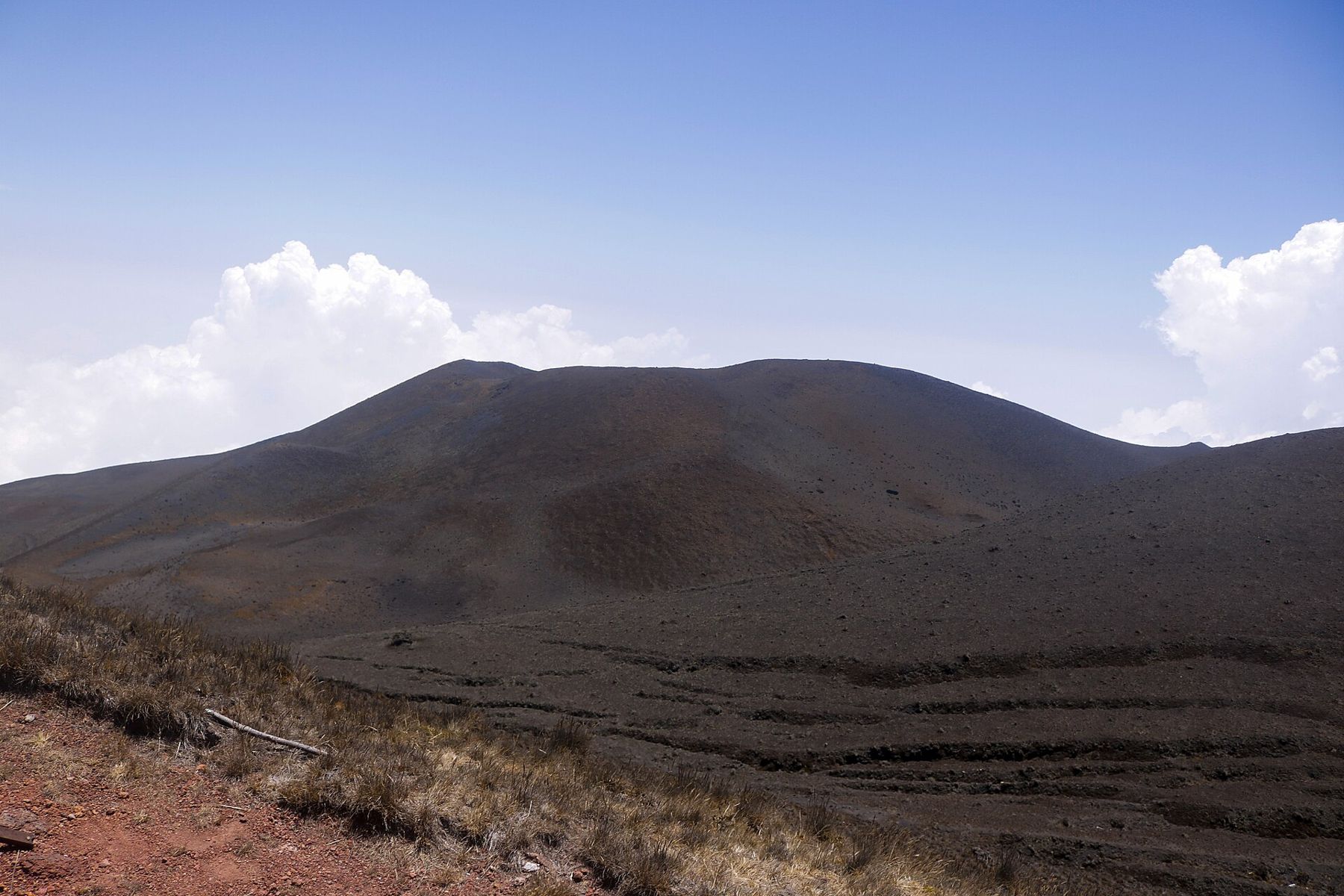
On a clear day the view from the top stretches over the coast and the Gulf of Guinea, and sometimes to the island of Bioko offshore. Clear days are not guaranteed; many climbers reach the summit in thick cloud. Starting early gives you the best chance of a view before the cloud builds.
The forest belt is rich in plants, some of them found only on this mountain, and it shelters forest elephants, primates and many birds. Large animals are rarely seen from the main path, but birdlife is good in the early morning, and the change in plants as you climb is striking in itself.
The race to the summit La course vers le sommet
Each year, usually in February, the mountain hosts a race in which runners go from Buea to the summit and back in a single day. Elite runners complete it in a time that seems impossible to anyone who has walked the route. The race draws crowds and brings a festive atmosphere to the town. If you plan to climb, find out whether and when the race is scheduled, as paths and huts are busy around that time.
Watching the race is a good way to share in the life of the town even if you have no plans to climb. Crowds line the streets of Buea for the start and the finish, music plays, and local runners who have trained on these slopes for months are cheered home as heroes.
A volcano that still erupts Un volcan toujours actif
Mount Cameroon is one of the most active volcanoes in Africa. It erupted several times in the twentieth century, and eruptions in 1999 and 2000 sent lava down its slopes; the 1999 flow crossed the coast road west of Limbe. Small earthquakes are felt from time to time. The volcano is monitored, and climbs may be suspended when activity increases, so ask in Buea about the current situation.
Security, seasons and what to pack Sécurité, saisons et bagages
The mountain lies in the Southwest Region, which has been affected since 2016 by the Anglophone crisis, a conflict between armed separatist groups and government forces. There have been attacks and kidnappings in the region, and climbing activity has been disrupted at times. Check your government's current travel advice before planning a climb, follow it, and keep your plans flexible. Travel to Buea by day and carry your passport for the checkpoints.
The best time to climb is the dry season, roughly December to February, when the paths are firmer and the views clearer. In the rainy months the forest is muddy, cloud is almost constant and the slopes facing the sea receive very heavy rain. Most visitors fly into Douala and reach Buea by road in a couple of hours. Bring cash for fees and porters, as cards are rarely accepted, and see planning a trip to Cameroon for visas, health rules and the yellow fever certificate.