Mount Cameroon and the west / Le mont Cameroun
Buea, the cool town on the slope
Halfway between the coast and the summit of Mount Cameroon, Buea is a cool, green university town with a German past, tea estates on its doorstep and clouds that roll in every afternoon.
Buea climbs the lower slopes of Mount Cameroon at around a thousand metres above sea level, high enough to escape the worst of the coastal heat. Its streets wind uphill through trees and gardens towards the forest edge, and on a clear morning the mountain looms directly above town. By afternoon, cloud often settles over everything and a fine rain begins. It is a small place with a large history.
For many visitors Buea is simply the base for climbing the mountain, but it deserves a day of its own. Its story touches German rule, the British mandate, reunification and the English-speaking identity of the region, and much of that story can be read in its buildings and streets.
A town on the mountain's flank Une ville sur le flanc de la montagne
Buea is the home of the Bakweri people, who have farmed the slopes of the mountain for generations. Today it is the capital of the Southwest Region and a university town, with a population that has grown quickly in recent decades. The upper town, with its older buildings and quieter roads, feels very different from the busy commercial streets lower down around Molyko and the university.
A walk through the upper town takes in German-era buildings, the old administrative quarter and leafy streets with views down the slope towards the coast on clear days. The market in the lower town shows what the mountain produces: plantains, cocoyams, vegetables from the high farms and fruit from the plantations, brought in by farmers from the villages around.
The German years Les années allemandes
When Germany ruled Kamerun, the colonial administration moved its seat from the hot coast to the cooler air of Buea in the early 1900s. A governor's residence, a stone building with towers known locally as the Schloss, was built on the upper slopes, and several other German-era buildings survive around it. The residence remains in official use, so view it from the outside and respect any restrictions on photography near government buildings.
After the First World War, the area passed to Britain under a League of Nations mandate and was governed as part of the British Southern Cameroons. That history explains why English is the main official language here, alongside the Pidgin English heard everywhere in the streets.
A capital, then a university town Une capitale, puis une ville universitaire
In 1961, the Southern Cameroons voted to join the former French Cameroun, which had become independent the year before. Buea became the capital of West Cameroon in the new federal republic until the federation was replaced by a unitary state in 1972. Its government buildings from those years still stand.
The University of Buea, an English-speaking university, has shaped the town since the 1990s. Students fill the cafés, shared taxis and markets of Molyko, and the area has the bustle of any university district. It also makes Buea one of the easiest places in the country to get around in English.
Around the campus, small eating places serve quick, cheap meals to students, and it is a good area to try everyday Cameroonian dishes such as eru, a stew of finely shredded leaves cooked with palm oil, which is closely associated with the Southwest.
Detour / détourClimbing Mount CameroonTea on the slopes Le thé sur les pentes
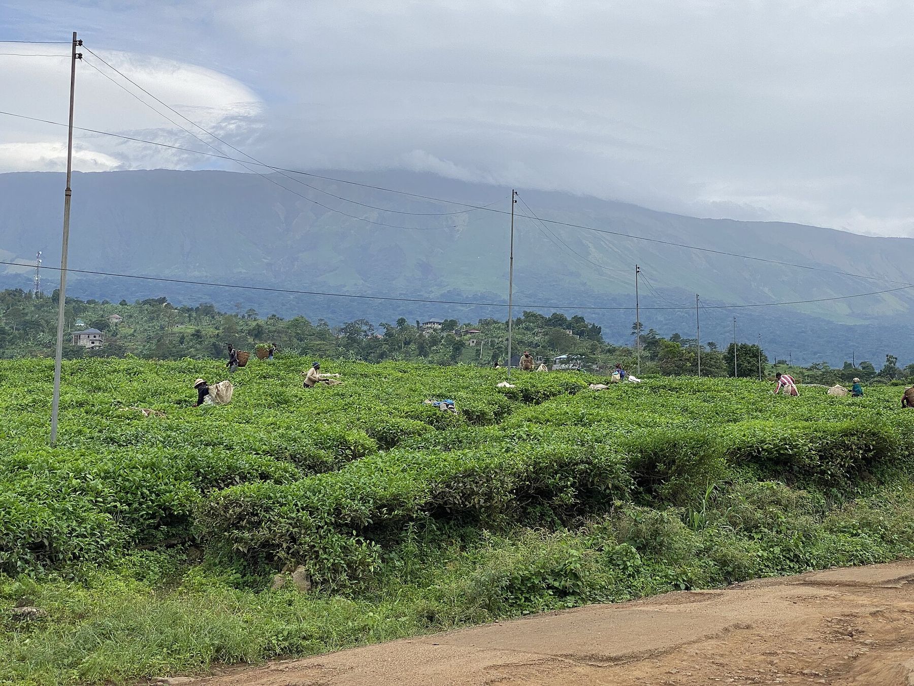
Below the town, the Tole tea estate covers rolling hills with bright green rows of tea bushes. Workers pick the leaves by hand and carry them in baskets on their backs, and the factory processes the leaf nearby. The estate is a working agricultural business rather than a visitor attraction, so ask permission before walking among the rows and before photographing people at work.
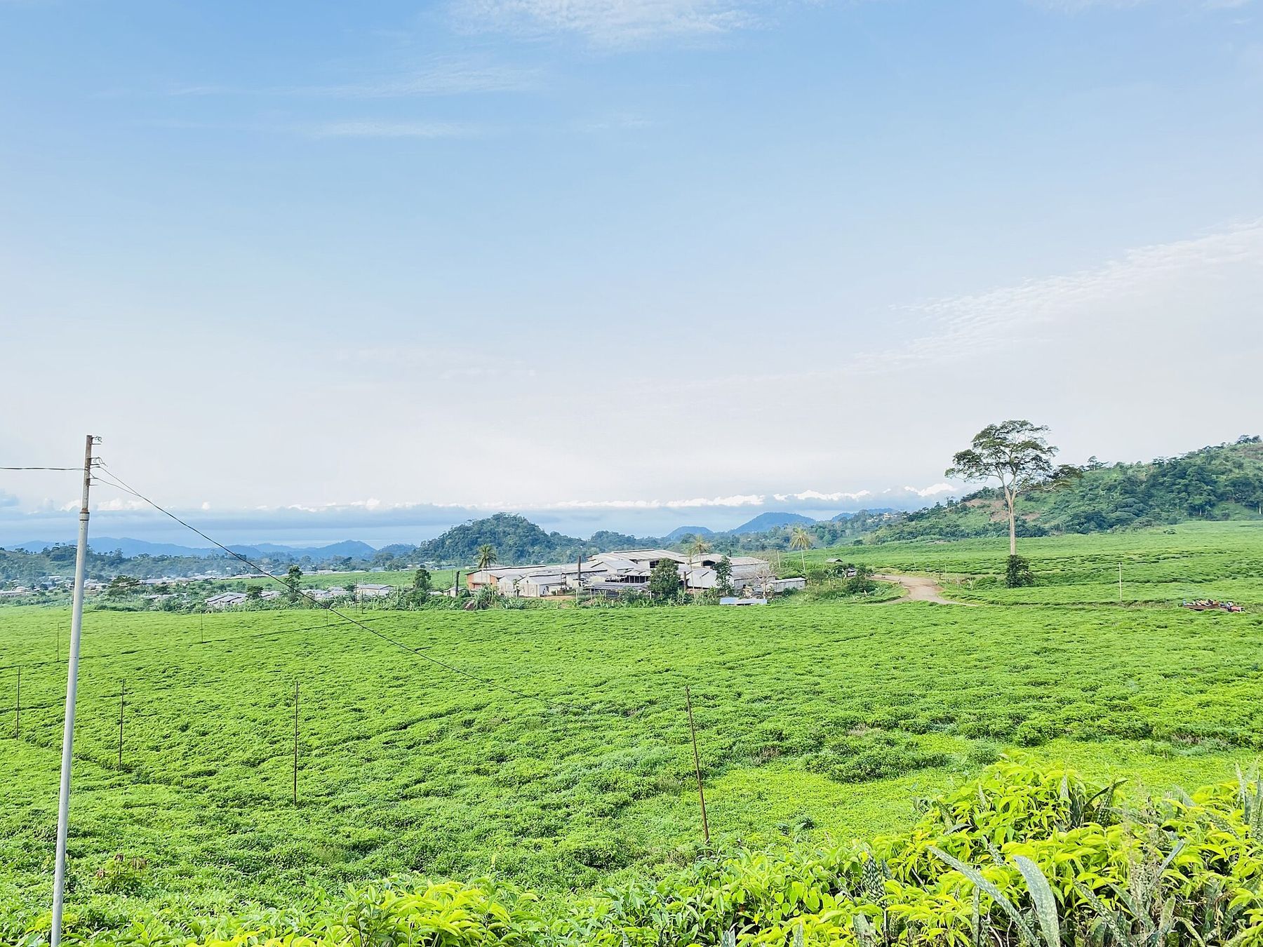
The wider slopes of the mountain are also covered with plantations of palm oil, rubber and bananas, many of them begun in the German period. They are a major employer in the region, and the roads between Buea, Limbe and Tiko pass through long stretches of them.
Mountain weather La météo de montagne
Buea's climate surprises visitors from the coast. Mornings can be fresh, evenings cool, and the town is often wrapped in mist. The rainy season is long and heavy, roughly from the middle of the year into the autumn, and even in the drier months from about November to February, afternoon showers are common. Pack a warm layer and an umbrella.
The town is the starting point for the climb to the summit of Mount Cameroon, and guides and porters are organised here. Even if you do not plan a full ascent, a walk to the forest edge above town gives a sense of the mountain's scale.
Ask locally about short walks on the lower slopes, and go with someone who knows the paths, as mist can roll in quickly and tracks divide among the farms.
Before you go Avant de partir
Buea lies in the Southwest Region, which has been affected since 2016 by the Anglophone crisis, a conflict between armed separatist groups and government forces. There have been violent incidents, lockdowns and disruption in and around the town. Check your government's current travel advice before planning a visit and follow it. If you go, travel by day, carry your passport for checkpoints and keep in touch with local contacts.
Most visitors arrive through Douala and reach Buea by road in about two hours, depending on traffic. Carry cash, as cards are rarely accepted, and check visa and health rules, including the yellow fever certificate, before you travel.